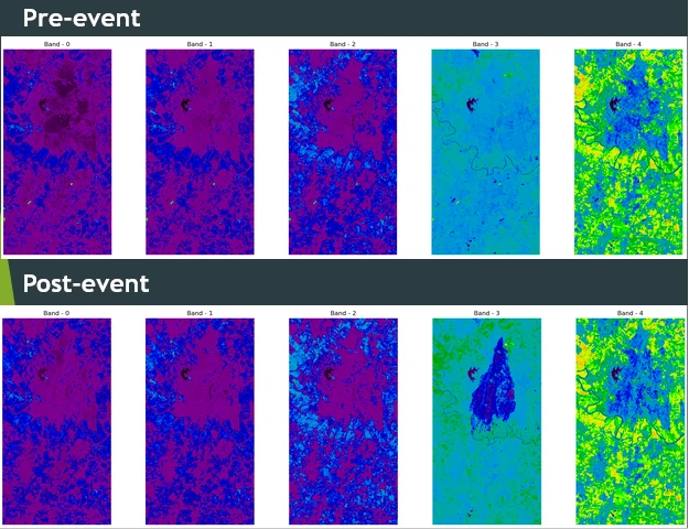
Change detection in multitemporal remote sensing images
geospatial
map
change detection
multitemporal
remote sensing
Change detection involves analyzing 2 or more multitemporal remote sensing images covering the same area to find any changes that may have occurred at different times.